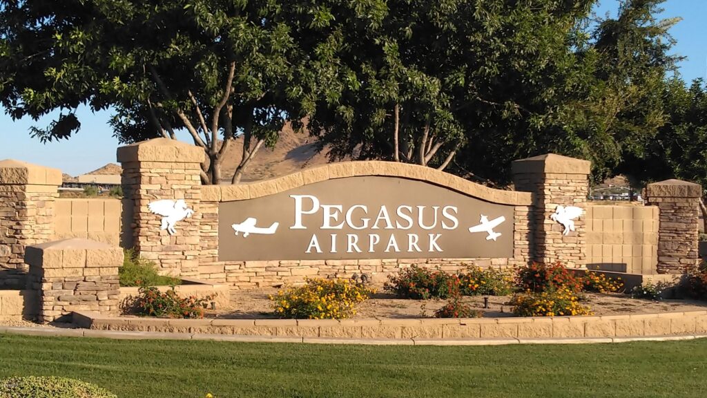
Welcome to the official Pegasus Airpark Flight Association site!
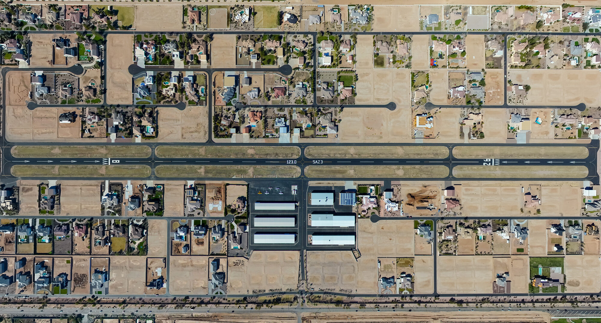
Located just South of Queen Creek near the US 60 and San Tan 202, and AZ 24 freeways, Pegasus is an airpark with 5100′ x 80′ paved runway that is enclosed by a gated residential community where surrounding residents have one acre homes with taxiway access.
Pegasus Airpark is close to downtown Queen Creek where you’ll find shopping and entertainment and the nearby San Tan Mountains where residents and visitors enjoy access to hiking, mountain biking and equestrian trails.
Location Information for 5AZ3Coordinates: N33°12.52′ / W111°37.03′
Located 3 miles S of downtown Queen Creek, Arizona on 320 acres of land.
Estimated Elevation is 1451 feet MSL.
| Airport Use: Private Use Activation Date: May 1998 Status: Operational Control Tower: No Seg-Circle: No Beacon: None Wind Indicator: Yes, Not Lighted Lighting Schedule: SEE RMK | A.R.T.C.C.:ALBUQUERQUE F.S.S.:PRESCOTT Sectional Chart:PHOENIX AirspaceAnalysis:CONDITIONALPRVDD VFR; PVT USE. Attendance:Unattended |
Airport Communications
| CTAF: | 123.000 |
| UNICOM: | 123.000 |
| AWOS-3 at IWA (5.7 N): | 133.5 – Phone: 480-988-9428 |
| ATIS at IWA (6.3 N): | 133.5 – Phone: 480-988-9428 |
| AWOS-3PT at CHD (10.2 W): | 128.325 – Phone: 480-814-9952 |
| Dimensions: | 5124 x 80 feet / 1562 x 24 meters | |
|---|---|---|
| Surface: | Asphalt | |
| Edge Lighting: | High Intensity | |
| Runway 08 | Runway 26 | |
| Coordinates: | N33°12.52′ / W111°37.54′ | N33°12.53′ / W111°36.53′ |
| Elevation: | 1436.9 | 1451.3 |
| Displaced Threshold: | 921 Feet | 911 Feet |
| Obstacles: | 175 ft Power Line 1519 ft from runway | 175 ft Power Line 1519 ft from runway |
Ownership Information
| Ownership: | Privately Owned | |
|---|---|---|
| Owner: | PEGASUS AIRPARK FLIGHT ASSOCIATION | |
| 150 E ALAMO DR #3 | ||
| CHANDLER, AZ 85225 | ||
| 480-967-7182 | X 103 | |
| Manager: | METRO PROPERTY SERVICES | NELSON GARRISON (602-571-3297) PAT MCCLURE (602-432-3086) LINDA KELLOGG (480-967-7182 EXT103) |
| 150 E ALAMO DR #3 | ||
| CHANDLER, AZ 85225 | ||
| 480-967-7182 | X 103 |
Other Remarks
- 175 FT PLINE LOCATED 1/4 NM SOUTH OF RWY 08/26 AND RUNS PARALLEL TO RWY.
- INSIDE GATED COMMUNITY. NO ACCESS BY PUBLIC.
- FOR CD CTC PHOENIX APCH AT 602-306-2565.
- ACTVT HIRL RWY 08/26 – CTAF.
Nearby Airports with Instrument Procedures
| ID | Name | Heading / Distance | ||
|---|---|---|---|---|
 | KIWA | Phoenix-Mesa Gateway Airport | 342° | 6.2 |
| KCHD | Chandler Municipal Airport | 290° | 10.4 |
| P19 | Stellar Airpark Airport | 289° | 16.0 |
| KFFZ | Falcon Field Airport | 339° | 16.1 |
| KCGZ | Casa Grande Municipal Airport | 206° | 17.0 |
| P08 | Coolidge Municipal Airport | 149° | 19.0 |
| KPHX | Phoenix Sky Harbor International Airport | 304° | 24.0 |
| KSDL | Scottsdale Airport | 329° | 28.8 |
| KDVT | Phoenix Deer Valley Airport | 321° | 37.0 |
| KGEU | Glendale Municipal Airport | 299° | 39.0 |
| KGYR | Phoenix Goodyear Airport | 288° | 40.2 |
| KLUF | Luke AFB Airport | 297° | 43.2 |
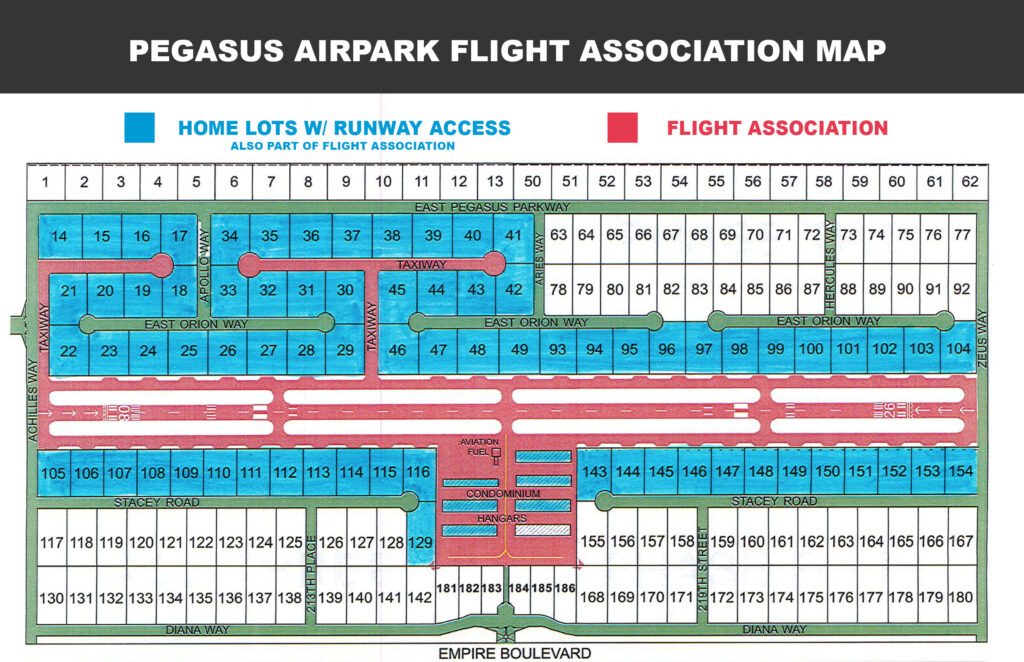
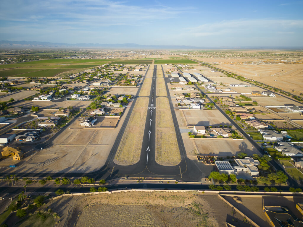
Image Date: 02.17.2022
Feel free to Contact Us if you have questions or comments.